Apple Valley State Route 18
Improvements Project
Background
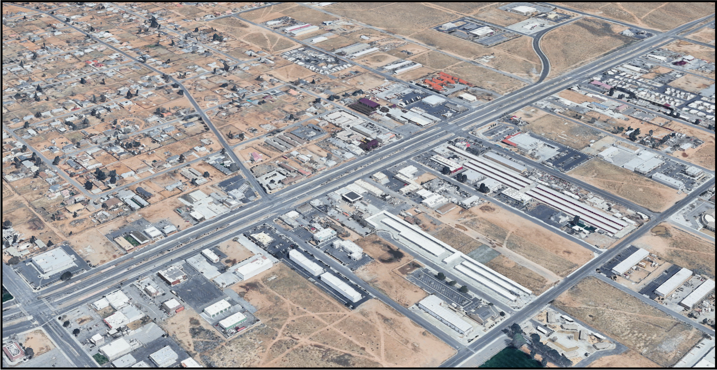
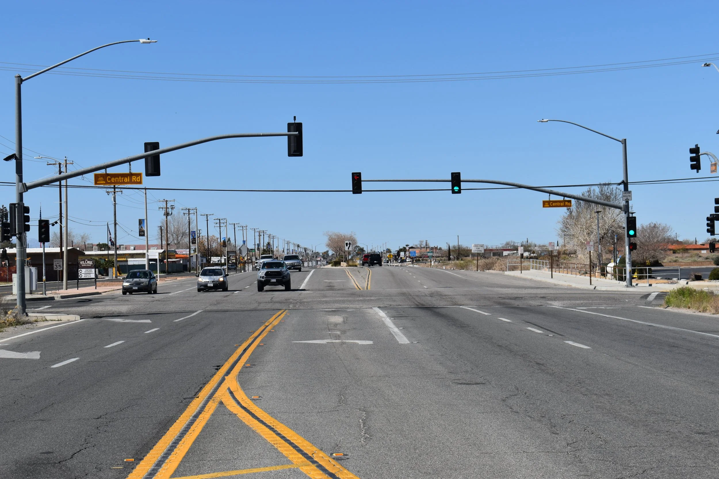
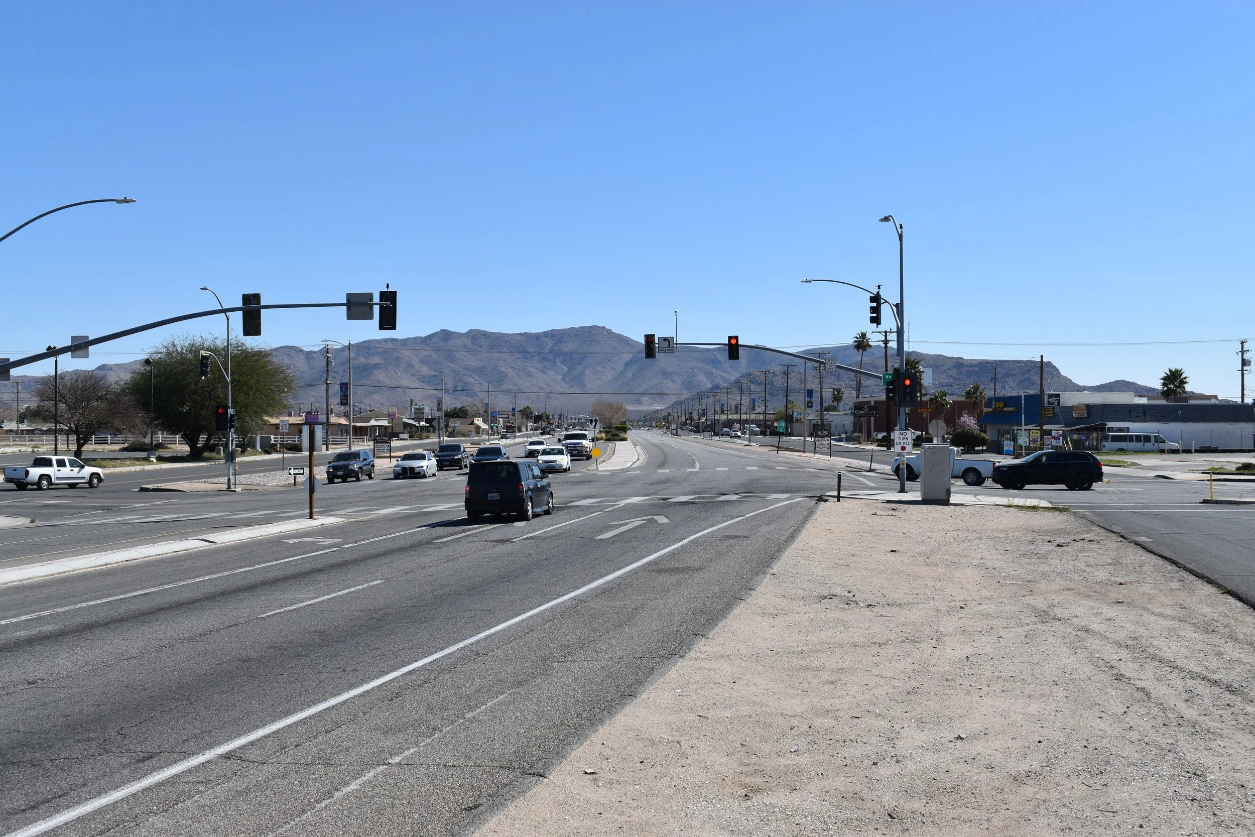
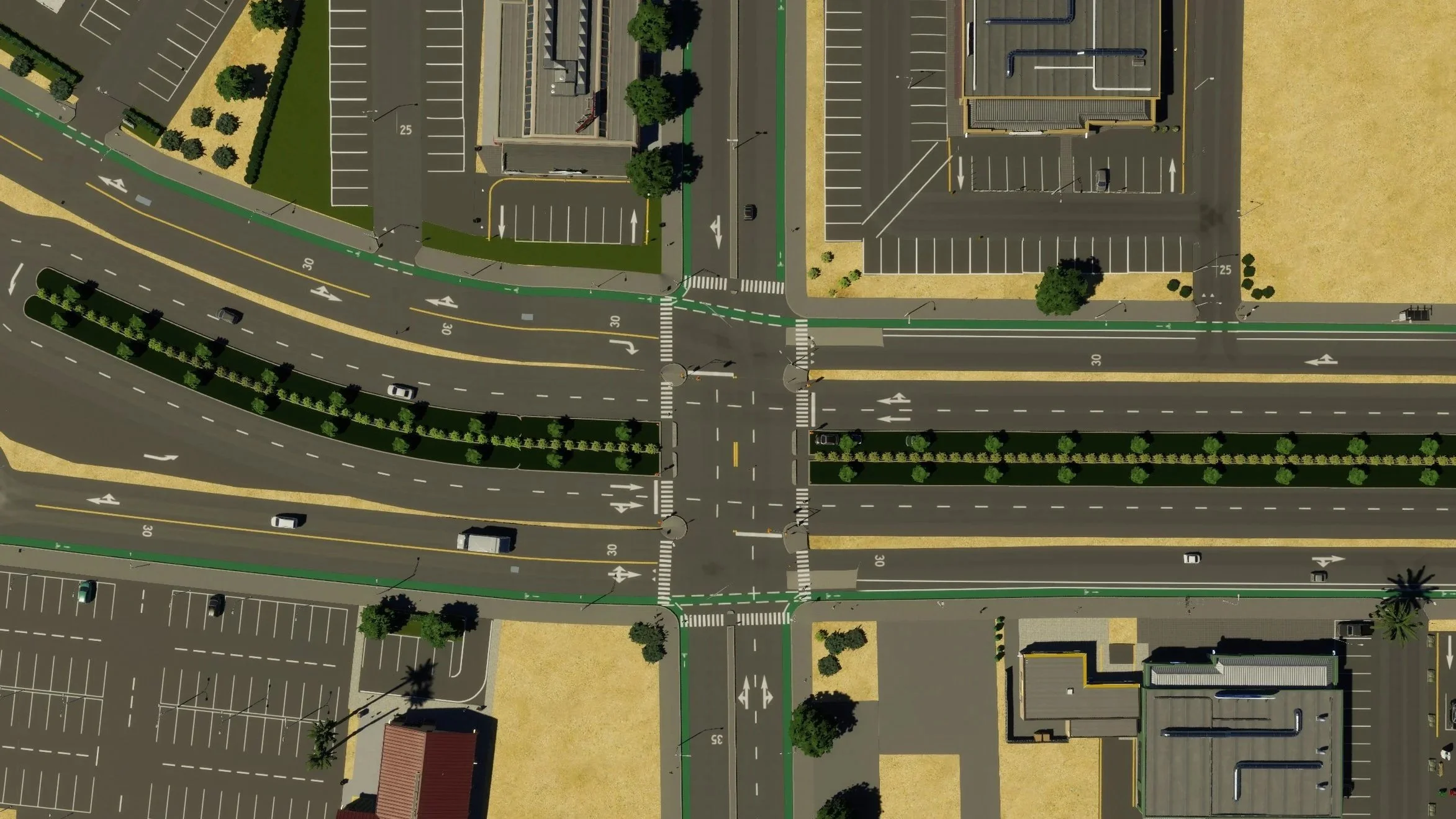
The Project focuses on a one-mile segment of State Route 18 in Apple Valley, extending from Navajo Road to Central Road. This corridor functions as a key east–west route for both regional and local traffic, with a unique layout that includes outer highways providing access to nearby businesses and residences. However, studies found show that this unique corridor creates multiple conflict points which lead to an increase in broadside collisions. Additionally, with the ever-growing businesses along the Project site, the corridor lacks multimodal infrastructure, highlighting the need to address improvements.
Public Service Announcement (PSA)
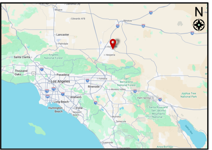
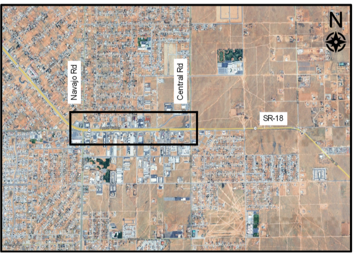
Navajo Road to Central Road
Apple Valley, CA
Alternatives
Alternative 0: No Build
Existing conditions of the intersections will remain in place. The No Build will leave the current conditions as is, no development, design, or construction will go into effect.
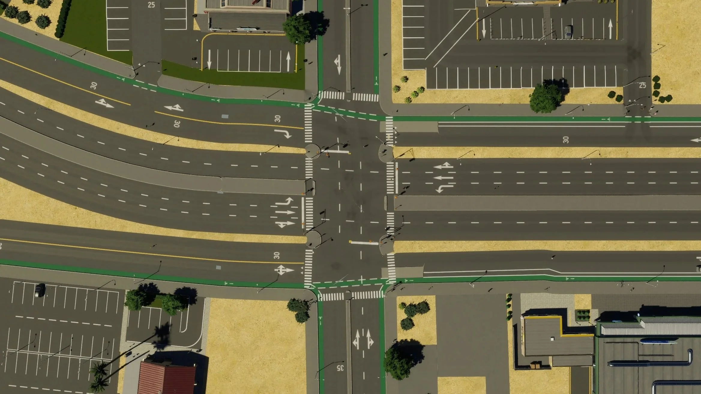
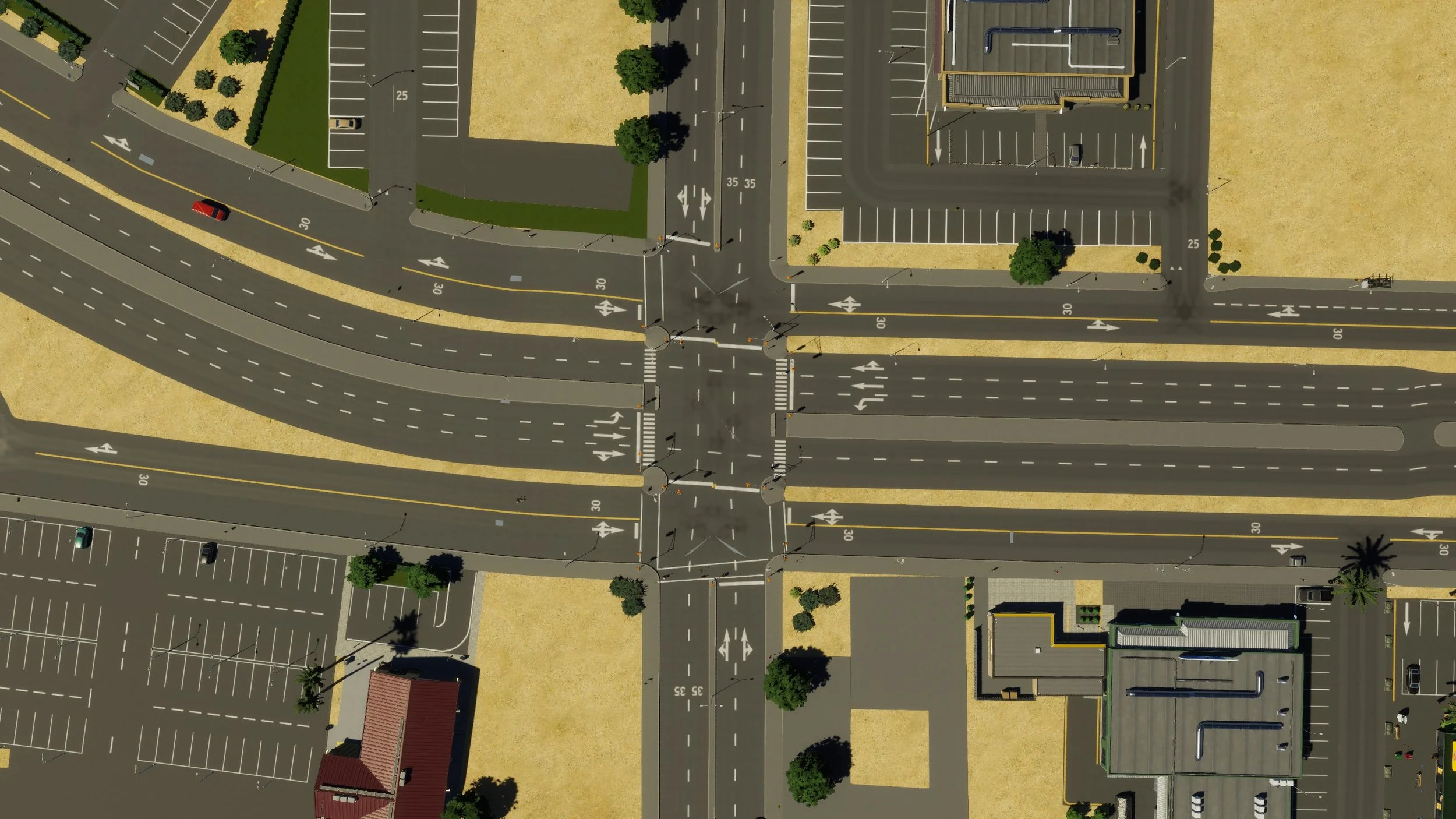
Alternative 1: Outer Highway 18 Enhancements
The Outer Highway 18 Enhancements alternative will address the usage for all modes of transportation along the corridor. This alternative aims to reduce turning speed by proposing bulb-outs at key intersections. Additionally, the outer highways will be converted to one-way travel with proposed bike lanes and implemented bus pads along these roads which will continue to provide parking for access to businesses along the project site. Finally, additional bike lanes along the intersecting roads of Navajo, Quinnault, and Central are proposed with included road diets. In order to construct the enhancements along the outer highways, right of way is required.
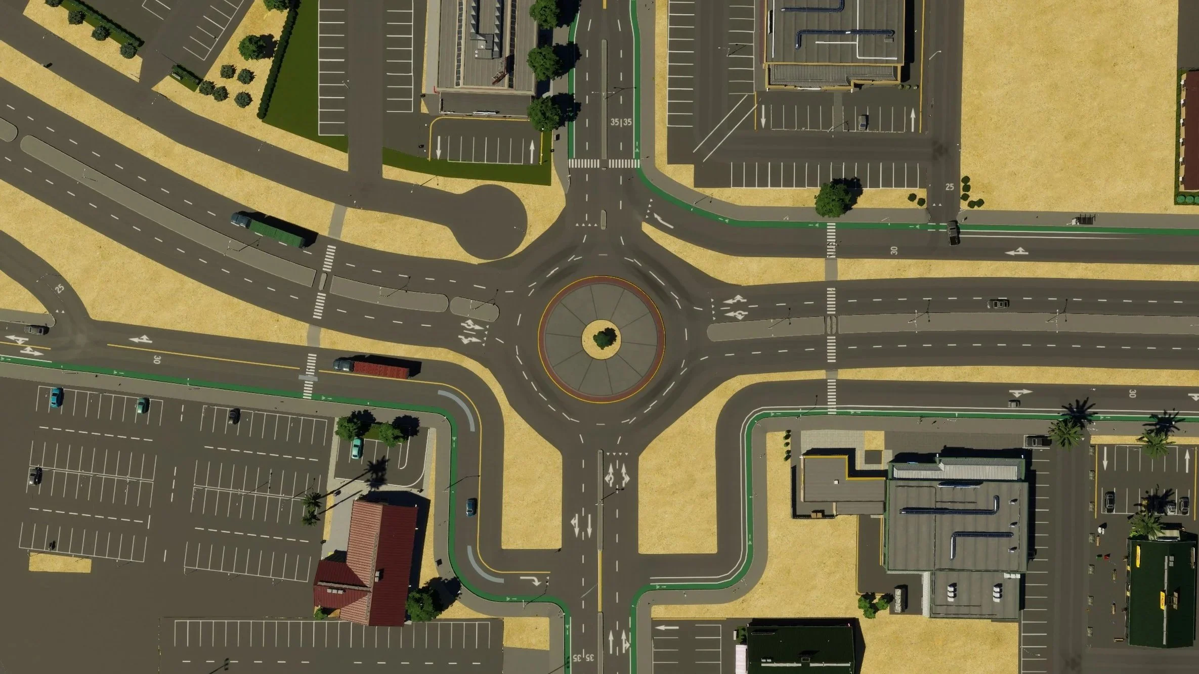
Alternative 2: Roundabouts
The Roundabouts alternative will build off Alternative 1, implementing the same road diets and proposed multi-modal connectivity improvements. Additionally, this alternative will add two roundabouts at the Navajo and Central intersections. In order to maintain existing access to the businesses along the Project Site, the outer highways will be realigned and two proposed cul-de-sacs will be placed along the north-west and south-east outer highways at the Navajo and Central Road intersections respectively, which will require parcel acquisition.
Alternative 3: Michigan Left
The Michigan Left alternative builds off Alternative 1, implementing similar road diets and proposed multi-modal connectivity. Additionally, this alternative will build off of Alternative 2, which proposes a realigned frontage road along the north-west Navajo Road intersection, which includes parcel acquisition. This alternative aims to reduce conflict points at the intersections along SR-18 by restricting Left-turn movements at all intersections between Navajo and Central Road and replacing them with proposed U-turn lanes that will be implemented between intersections. In order to complete this design, the median along SR-18 will be widened to allow for all vehicle types to perform U-turn movements.
Deliverables
The Preliminary Environmental Analysis Report (PEAR) provides a comprehensive review of the environmental investigations based on environmental impacts such as biological, paleontological, climate change, hazardous materials, and even some social impacts such as Cultural, visual, and community impacts.
The Project Study Report (PSR) summarizes the technical analyses, design concepts, and environmental considerations used to identify a recommended alternative. The PSR serves as the basis for future project development and coordination with local and regional agencies.
The Intersection Safety And Operational Assessment Process (ISOAP) provides a comprehensive review of the traffic investigations based on the interaction between the freeway mainline, ramp terminals, pedestrians, cyclists, and transit. The ISOAP uses existing conditions, active transportation facilities, transit routes, crash analysis, and Safe Systems Approach in the data analysis.

Benefit/Cost Analysis
Evaluates the benefit to cost ratios for each proposed alternative based on the total vehicle delays, overall traffic safety, emissions rates, and reliability.

Construction Staging Plan
Presents plans for the construction phases for the preferred alternative.

Cost Estimate
Displays the total project costs based on costs for earthwork, roadway items, ROW, and structure items for each alternative.

Weighted Decision Matrix
Evaluates ratings based on eight criteria and the rating for each alternatives to choose the most feasible alternative.
Our Team
-

Noah Collado
Co-Project Manager
-

Charbel Salloum
Co-Project Manager
-

Rey Anthony Reynaldo, EIT, ENV SP
Environmental Lead
-

Nathan Kakish
Environmental Member
-

Zach Crow, EIT
Traffic Lead
-

Andres Sevilla, EIT
Traffic Member
-

Dylan Hudson, EIT
Traffic Member
-

Luis Prado
Traffic Member
-

Kenny Kim, EIT
Design Lead
-

Andrew Perez
Design Member
-

Pablo Sanchez
Design Member
-

Yuyi Wu
Design Member
-

Justine Niu, PE
Caltrans District 8 Advisor
-

Jason Collado, PE
Caltrans District 8 Advisor
-

Dr. Yongping Zhang, PE
CPP Faculty Advisor